写真で見る田中野田の変遷 -令和版-
平成12年にふれあい新聞特別号として「区画整理で生まれ変わった田中野田」を発行しました。
編集後記には、「思うに今からおよそ10年後、懸案のバイパスが高架の車道で全通している頃には町内の様子も大きく変わり、再びこのような冊子の企画がもちあがるのではなかろうか」とあります。
その10年後、平成23年にふれあい新聞100号記念号の発行に合わせ「写真で見る田中野田の変遷」を旧ホームページに作成しました。あとがきには、「180号岡山西バイパスが平成23年3月27日全線5.6kmが開通したことにより交通量は増大し、周辺には店舗が並び予測どおり大きく変貌している。しかしながら、西長瀬交差点、野殿交差点が県道と直接交差している為、交通渋滞を起こしているのが課題である。当初の計画の全線高架道路の実現はいつのことであろうか」とあります。
さらに10年後、平成4年の現在、令和の様子を撮影しました。また、岡山環状道路の整備が進んでおり、西バイパスが交差する国道2号線大樋橋には高架がかかりました。前述の西バイパス「高架道路」の実現はいつになるのかわかりませんが、地域はどんどん変貌をとげています。
当町内会は令和4年5月に岡山市電子町内会の新システムに移行したことを機に、令和4年の田中野田の写真を新たに加え、昭和~平成~令和の変遷をまとめた令和版としてアップしました。
これまで携わってこられた方々の写真や記録があってこそできた貴重な記録です。
懐かしんだり、未来を思い浮かべたりしながら時代の移り変わりを楽しんでいただけたら幸いです。
ふれあい新聞 特別号 -保存版-(平成12年9月)表紙より
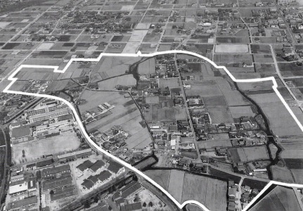
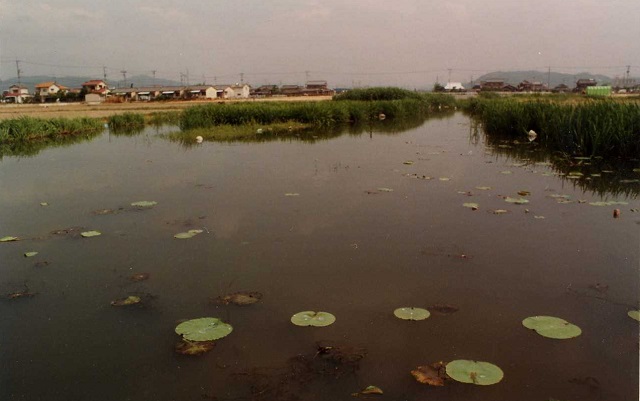
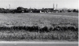
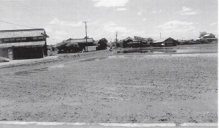
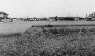
区画整理前(昭和60年頃)の田中野田
(白線内が区画整理事業の対象区域)
家屋は県道当新田ー中仙道線(バス路線)沿いに多いが、地区の大半はまだ水田が占めている。区画整理が先行した田中地区では、整然とした碁盤の目状の道路が見られる。
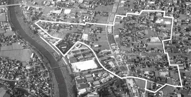
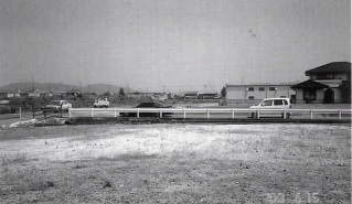
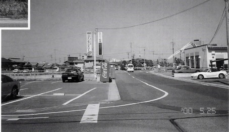
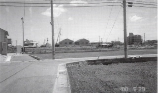
区画整理後(平成10年10月)の田中野田 (白線内)
家屋の増加と道路の整備が目立つ。世帯数は昭和60年に比べ倍増(裏面の下図参照)水田の多くは、地区を縦断する岡山西バイパス(未開通)沿いに残っている。
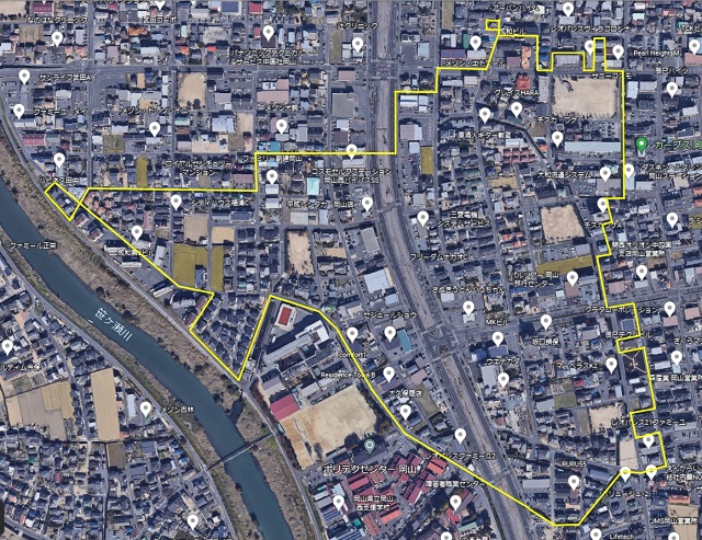
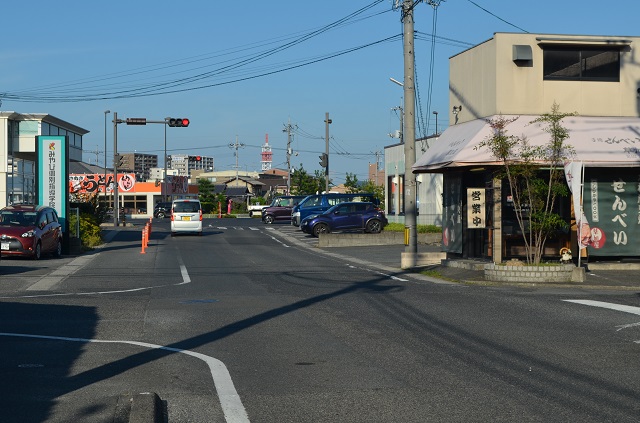
令和4年12月(作成時)の田中野田(黄線内)
平成23年(2011年)3月27日 国道180号岡山西バイパスが開通した。国道2号岡山バイパス (岡山市南区古新田)から一般国道180号(岡山市北区楢津)に至る延長5.6km。町内を縦断し東エリアに1~5組、西エリアに6~9組の組分けとなっている。残っていた多くの水田は宅地化が進み、今では数ヶ所となってしまった。(Google earth画像を加工)
田中野田〔東エリア〕
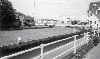
◆新橋の西〈昭和60年(1985年)頃 区画整理前〉
新橋とは…「新橋」は田中野田地区に人が住むようになって架けられた橋である。この橋の名称のいわれでもある。したがって新橋は、この地区の最も古い橋といえる。最初の橋は木造であったろう。それとも石橋だったろうか?
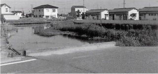
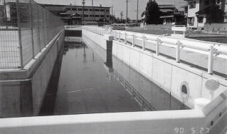
〈平成12年(2000年)区画整理後〉
水路は三方がコンクリートで整備され、荒れていた川田も立派な水田に。
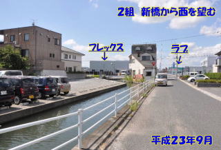
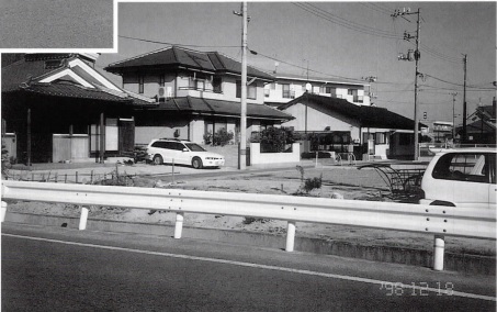
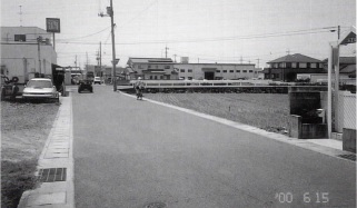
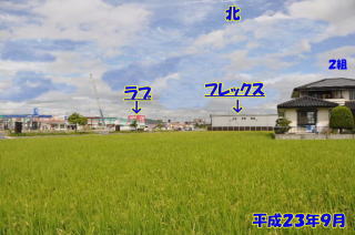
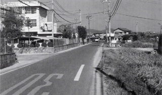
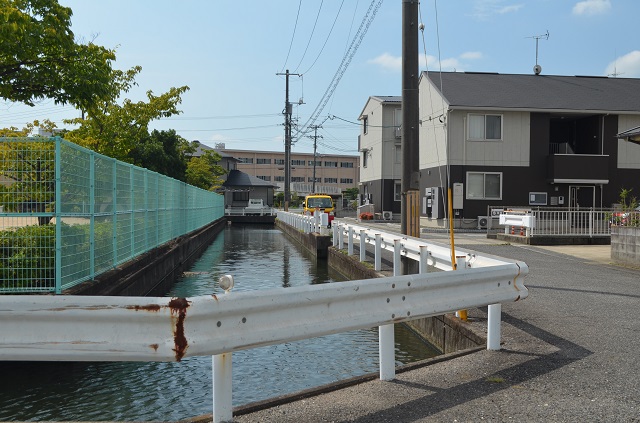
〈平成23年(2011年)9月撮影〉
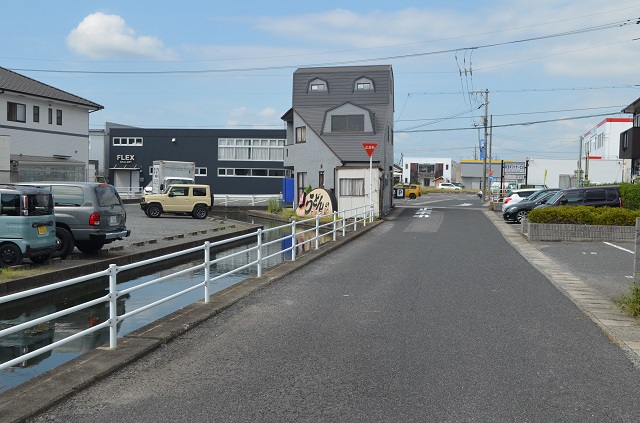
〈令和4年(2022年)9月撮影〉
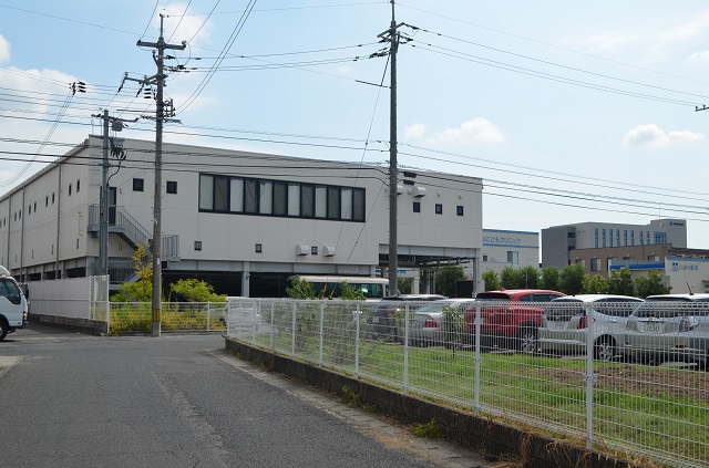
1組・2組に掛かる新橋より西バイパス方面を見る。黒い建物はフレックスギャラリー。
◆新橋の東〈昭和60年(1985年)頃 区画整理前〉
〈平成12年(2000年)区画整理後〉
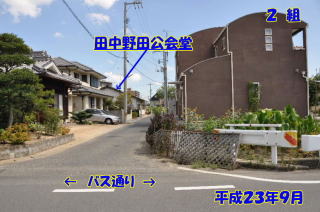
橋の東で大きくふくれていた野田川は、幅3.5mの三方コンクリートの水路に残りの水路敷は宅地となって、田中野田公会堂ほかの建物が立地する。
〈平成23年(2011年)9月撮影〉
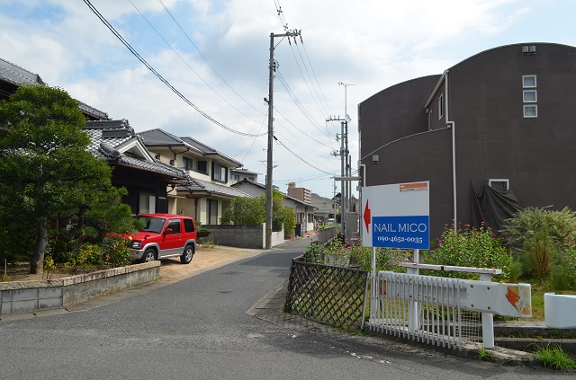
〈令和4年(2022年)9月撮影〉
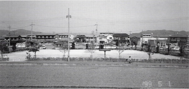
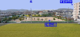
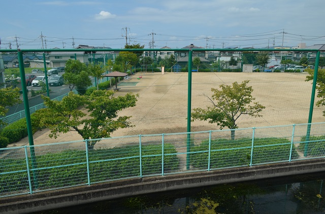
◆現在の3組 田中野田2号公園辺り
〈昭和60年(1985年)頃 区画整理前〉
田中野田2号公園〈平成12年(2000年)〉
区画整理で町内4ヶ所に公園が設けられた。
田中野田の東エリアには、辰巳西、田中野田2号、3号の3つの公園がある。
〈平成23年(2011年)9月撮影〉
〈令和4年(2022年)9月撮影〉
2号公園の東側から撮影
◆田園地帯がメインストリートに
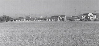
〈昭和60年(1985年)頃 区画整理前〉
田中野田と辰巳の境を流れるこの広い川(野田川)の向こうが田中野田である。町内の区画整理の工事もこの地点から始まった。
この写真の手前辰巳地区では、すでに大元ー辰巳線の道路が造成されていて、田中野田への接続工事が待たれていた。
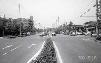
◆大元-辰巳線〈平成12年(2000年)〉
幅員27m、中央分離帯をはさんで4車線の車道と、両側に歩道の整備がされたこの道路の完成に伴い、周辺に次々と事業所のビルが建ち並んだ。この道路の街路樹や花木も大きくなった。まさに田中野田のメインストリートである。
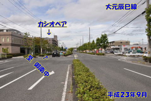
〈平成23年(2011年)9月撮影〉
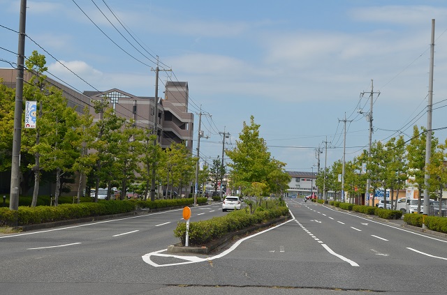
〈令和4年(2022年)9月撮影〉
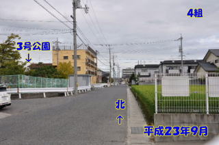
◆4組の東部1〈昭和60年(1985年)頃 区画整理前〉
◆3号公園付近から北を見る〈平成12年(2000年)〉
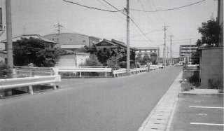
〈平成23年(2011年)9月撮影〉
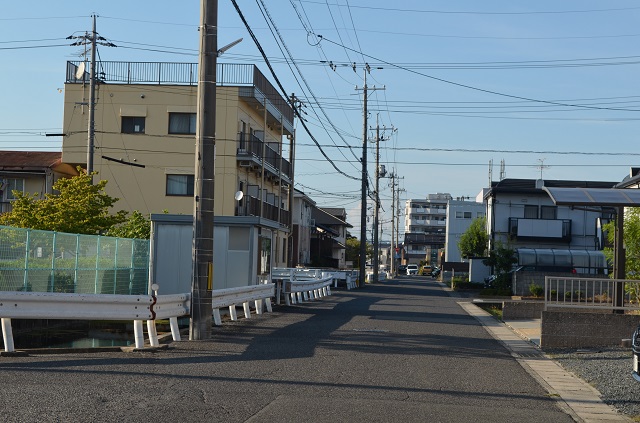
〈令和4年(2022年)9月撮影〉
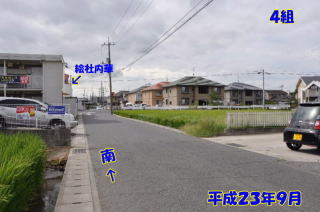
◆4組の東部2〈昭和60年(1985年)頃 区画整理前〉
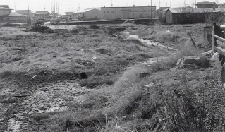
◆南に「絵社内華(店舗)」〈平成12年(2000年)〉
〈平成23年(2011年)9月撮影〉
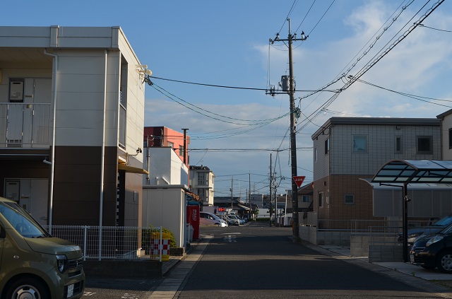
〈令和4年(2022年)9月撮影〉
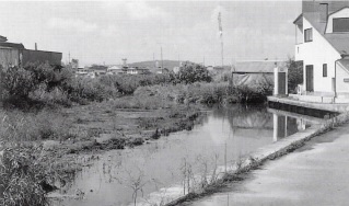
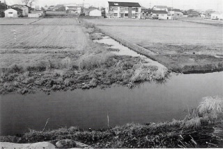
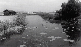
◆思い出の野田川が消える
〈昭和60年(1985年)頃 区画整理前〉
下の写真は田中野田中心部の周辺を流れていた川の一部である。往時、笹ヶ瀬川が堤防により河道が固定される以前、自由蛇行していた頃の名残だと言われている。
〈平成12年(2000年)〉
〈平成23年(2011年)9月撮影〉
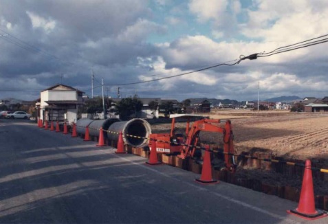
50m道路敷(注1:R180岡山西バイパス)や宅地、農地になっている。
〈令和4年(2022年)9月撮影〉
バイパス沿いの田んぼは店舗や宅地に姿を変え、西バイパスは通行量が増大している。今後、環状線として各地域での開発が進んでいる。
田中野田〔西エリア〕
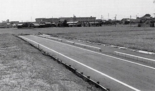
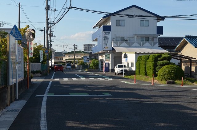
〈昭和60年(1985年)頃 区画整理前〉
しかし、両側の歩道と一車線の車道が通行できるだけで、工事は遅々として進まず、中央部分は草ボウボウ、完成はまだ先の先。この道路が完成すれば(中央車線は高架になるという)、この周辺は大きく変貌するであろう。平成12年発行 ふれあい新聞特別号より掲載。
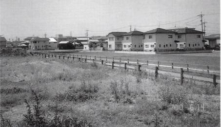
それにしても、この道路の周りは既に次々と開発されて建物が立ち並び、上の写真のように大きく見えていた御南中学校校舎も隠れてしまった。
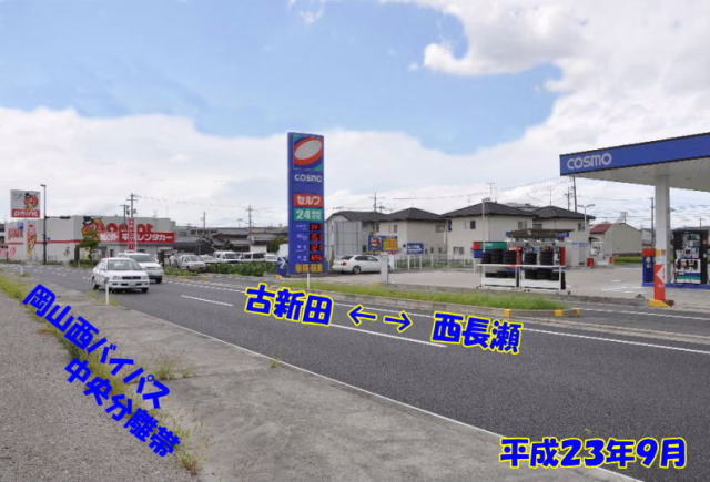
〈平成23年(2011年)9月撮影〉
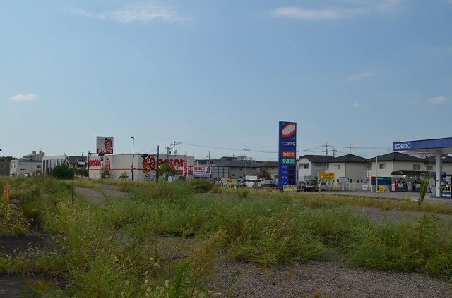
〈令和4年(2022年)9月撮影〉
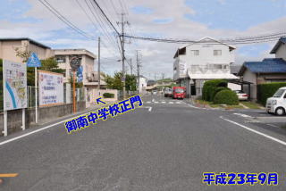
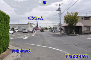
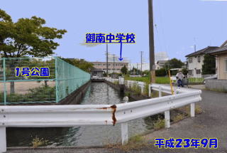
◆御南中学校正門付近
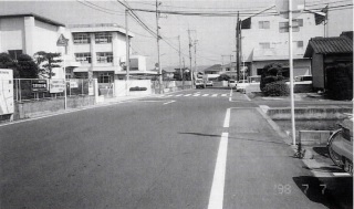
〈昭和60年(1985年)頃 区画整理前〉
御南中学校正門東側を笹ヶ瀬川旧堤防の道路が通っていた。区画整理ではこの旧堤防道路の斜面と堤防尻(稲が植えられていた)、そして堤防に沿って流れていた用水路を含めて、広い道路に整備された。現在、この道路沿いには新しいビルが建ち並ぶ。
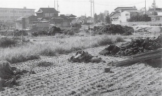
区画整理が始まった頃の写真。左奥の白い建物は「太田商店」。文具、日用品、パンや菓子、飲料、駄菓子、プラモデルなども売っており、御南中生徒や近所の人が買いに来ていた。店の横から北へ延びる道は、田中町内へとつながっていた。
〈平成12年(2000年)区画整理後〉
〈平成23年(2011年)9月撮影〉
〈令和4年(2022年)9月撮影〉
◆御南中正門近くの旧堤防道路からの写真だが現在は…〈昭和60年(1985年)頃 区画整理前〉
〈平成12年(2000年)区画整理後〉
下は7組のマンション「セジュールショウ」南より写す。この写真では、電話局の鉄塔が道路の中央、小さく見える白い自動車の向こうにのぞいている。上の写真とまあまあ一致するので、田園だったこの辺りがこうも変わってしまったかを実感できる。
〈平成23年(2011年)9月撮影〉
〈令和4年(2022年)9月撮影〉
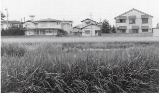
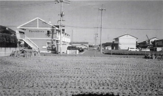
◆7組から3組の家並みを写したもの
〈昭和60年(1985年)頃 区画整理前〉
〈平成12年(2000年)区画整理後〉
〈平成23年(2011年)9月撮影〉
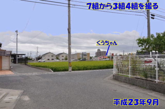
〈令和4年(2022年)9月撮影〉
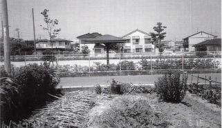
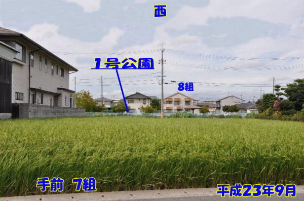
◆田中野田1号公園の東から
〈昭和60年(1985年)頃 区画整理前〉
7組から8組方面を見る。8組との間に田中野田1号公園が作られる前。ここと東エリアに3ヶ所、計4ヶ所の公園が町内に設けられることに。
〈平成12年(2000年)区画整理後〉
手前に道路、田中野田1号公園の向こうには用水路が新設された。8組の住宅地が見える。
〈平成23年(2011年)9月撮影〉
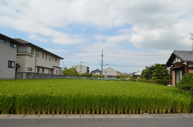
〈令和4年(2022年)9月撮影〉
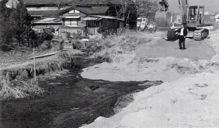
◆無くなった「うずん橋」
〈昭和60年(1985年)頃 区画整理前〉
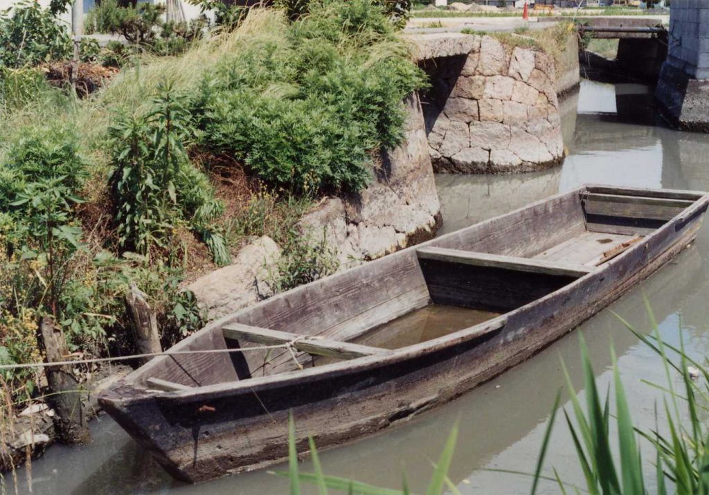
この写真の橋は「埋橋(うずめばし)」である。ただし「うずんばし」と呼ばれていた。橋桁を高くしているのは、夏季に水位が増してもこの下を「川舟」が通れるようにとの配慮からである。
この川舟は農機具や肥料、農産品(籾・い草等)などの運搬に用いられ、当時、農家にとってはなくてはならないものであった。
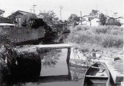
この川舟で籾やワラ、農機具などを運んでいた。
〈平成12年(2000年)区画整理後〉
思い出多い「うずんばし」も川も区画整理でなくなった。そして今は、橋のあった場所が農地になり、橋の向こうは宅地や新設の道路になり、「田中野田1号公園」の一部に変わっている。
〈平成23年(2011年)9月撮影〉
〈令和4年(2022年)9月撮影〉
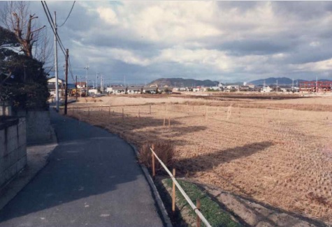
〈昭和60年(1985年)頃 区画整理前〉
御南中から田中へ向かうこの1本道は、集落をつなぐ往来道だった。
区画整理が始まり、田んぼに杭が打たれている。50m道路(西バイパス)が作られる前の様子。
令和現在の場所は、釣り具ポイント裏側あたり。
◆新しい水路へ〈昭和60年(1985年)頃 区画整理前〉
古い水路は「うずんばし」の下を流れていた水路で、中学校校舎北の2階建ての家屋の裏を通り、田中水門に通じていた。
〈平成12年(2000年)区画整理後〉
田中野田1号公園の北側から南に向かう新水路に。
〈平成23年(2011年)9月撮影〉
〈令和4年(2022年)9月撮影〉
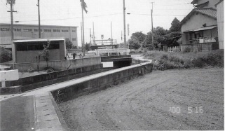
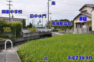
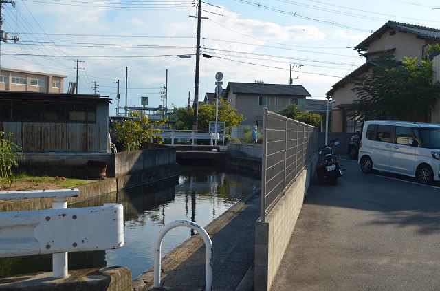
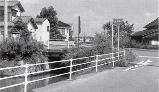
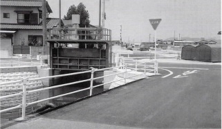
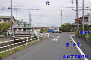
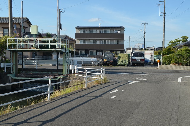
◆田中水門1 北側
〈昭和60年(1985年)頃 区画整理前〉
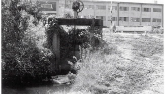
〈平成12年(2000年)区画整理後〉
近代化した田中水門。扉は橋の向こうへと位置を変え、開閉は手動から電動式になった。
〈平成23年(2011年)9月撮影〉
〈令和4年(2022年)9月撮影〉
平成23年頃まであった烏城彫協会(工場)が移転し、27軒の住宅団地が完成。後に新6組となった(コモンガーデン27K)。
◆田中水門2 南側
〈昭和60年(1985年)頃 区画整理前〉
〈平成12年(2000年)区画整理後〉
〈平成23年(2011年)9月撮影〉
〈令和4年(2022年)9月撮影〉
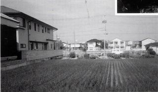
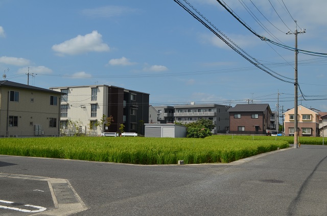
◆9組東の南北道路から東を見る
〈昭和60年(1985年)頃 区画整理前〉
〈平成12年(2000年)区画整理後〉
〈平成23年(2011年)9月撮影〉
〈令和4年(2022年)9月撮影〉
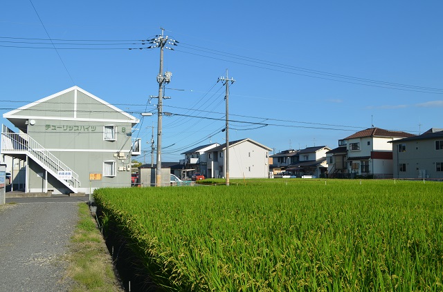
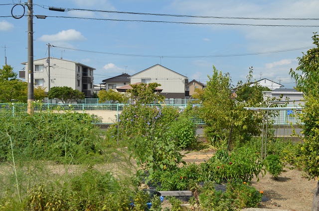
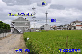
〈令和4年(2022年)9月撮影〉
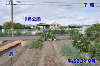
8組チューリップハイツ前の道路から南西方面を写す。
昭和の時代、田んぼばかりだった風景も令和4年現在、この付近での稲作はここの2ヶ所の田んぼだけとなっている。
